GyroTrack Tool
Post installation pipeline mapping services

The GyroTrack tool has a proven track record of over 500 successful surveys carried out on virtually every continent, this multi-diameter system provides the most accurate results on pipeline location.
Companies may use GyroTrack for mapping their product lines after using Prime Horizontal for the initial HDD services or they can use GyroTrack to map their existing pipeline and utility lines.
| GyroTrack Specifications | |||
|---|---|---|---|
| Diameter | 80 mm to 200 mm | 200 mm to 500 mm | 500 mm to 1200 mm |
| System Length | 1000 mm | 1200 mm | 1700 mm |
| Min. Bending Radius | 4500 mm to 660 mm | 2D | 2D |
| System Weight | 3 kg | 22 kg | 25 kg |
| Logging Rate | 500 hz | ||
| Calibrated Accuracy | 15 cm in XYZ over a 1000 m distance between Way Points** | ||
| Battery Autonomy | > 3 hours | ||
| ** Accuracies subject to many environmental factors and are more closely defined within each Post Job Report. Specifications may change without prior notice. | |||
Key Operating features:
- Large diameter range – operational range of ID 90 mm (3.5″) to ID 1200 (48″)
- Unaffected by magnetic influences
- Water resistant up to 5 bar/75 psi
- Able to map pipes of steel, concrete, HDPE or PVC
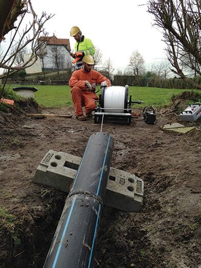
The GyroTrack tool with centralization, may be pulled either by a hand operated wireline or a mechanical winch. In certain cases, the tool may be pumped through the product line.
Output data can be exported to open platform formats for seamless integration into common, industry-standard GIS formats and saved to files such as AutoCAD, Excel, MicroStation and Notepad.

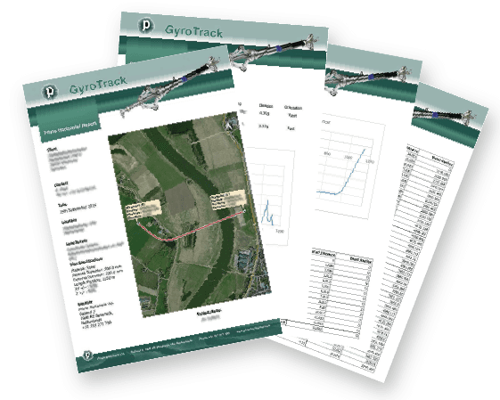
The on-site report includes at least the following attributes:
- Pipeline profile
- Bend radius report per customer defined intervals
- Inclination analysis
- Job specification
- Job locations
Here is an example of the GyroTrack Report after surveying is performed and is presented to end users.


